Documenting my family's past for future generations. My family tree includes the Smith/Mansell families of Alabama and Oklahoma, the Castle/Day families of Kentucky and Oklahoma, the Wheat/Ming families of Texas and Oklahoma, and the Bell/Roberts families of Mississippi, Tennessee, and Oklahoma.

Wednesday, June 21, 2017

Revolution Road Trip: The Mings and Edenton

Edenton, North Carolina, lies on the Albemarle Sound, a body of fresh water separated from the Atlantic Ocean by a portion of the Outer Banks. Edenton Colony was the first permanent settlement in North Carolina. The town was established in 1712 and incorporated in 1722, named for Governor Charles Eden, who had recently died; it is the county seat of Chowan (accent on the second syllable--Chowan) County. Edenton was an busy port in the 1700's. According to the North Carolina History Project, "Between 1750 and 1775, Edenton entered a period of great economic success and was a vital stop along trade routes between New England and the West Indies. Between 1771 and 1776, the records show that 827 ships passed through Edenton..."

Our association with Edenton comes from our Ming ancestors, who were early inhabitants of the area. (The following information is a result of the research of Ming descendants, including my cousin Paul E. Ming, who generously shared his research results with me.) Joseph Ming, son of David and Elizabeth (Carter) Ming of Bermuda, was the first Ming to live in North Carolina, having been granted 200 acres for bringing in seven settlers, including his son Thomas. Joseph Ming was a seafaring man, master of the sloops, Tyrall and Ruth of North Carolina. Records show that he came to Bath County NC in 1701; early maps show Bath County on the south side of Albemarle Sound, while later records indicate that Joseph owned land on the Yeopim River in Chowan County on the north side of the Sound.

While the Ming family first settled in Bath County, sometime after 1700 the sons of the elder Joseph are living in Chowan County, perhaps after the death of their father in 1707 or an Indian massacre that occurred in Bath County in 1711. In 1719 Joseph bought 150 acres of land in Chowan County. Sometime before 1722 Joseph married Rachel Ward, because in that year "James Ward deeded to planter Joseph Ming for a marriage already solemnized between Joseph and Rachel gave two plantations westward of Yoppim River Bridge, being 108 acres and 200 acres with cattle in Bridge Neck." By 1759 Joseph Jr. had acquired more than 508 acres of land in Chowan County.

Joseph and Rachel had six children: Thomas (born about 1734), Sarah, James, Mary, Joseph (III), and Annarita. Joseph's will, signed 1 December 1750, names his heirs as wife Rachel; sons Thomas and Joseph; daughters Sarah Wilkins, Annarita Collins, and Mary Ming (later Haughton); and grandsons, Joseph Wilkins and Thomas Collins. Joseph died by 16 July 1751 when an inventory of the estate was taken. 

Our ancestor is Joseph's son Thomas. His birth date of 1734 is estimated because Joseph's will of 1750 stated that he was not yet 18 and provided three more years of schooling for him. By 1752 he took over administration of his father's will from his brother Joseph who was in ill health, so at that point he must have been 18. Thomas married Delilah (probably Felton) in the early 1760's as their son James was born about 1765. Thomas was a miller; he owned a grist mill on a branch of the Yeopim River which divides Chowan from Perquimans County. It was paid for in full by 5 December 1766 and sold on 21 March 1768. During the 1760's and 70's Thomas and Delilah had seven children: sons Joseph, James, Thomas Jr., and Willy; and daughters Mary, Rachel, and Penelope.

By 1782 the family had moved to Edenton. In that year Thomas purchased a small house in town. According to tax records, he also retained ownership of 200 acres in Chowan County. In the first census of 1790 Thomas's household included two males over 16, one male under 16, four females, and ten slaves. Thomas made his will 6 November 1792 and had passed away by 1796 or early 1797. Marriages of Thomas and Delilah's children include: Joseph to Sarah Beasley; James to Ann Beasley (our ancestors); Thomas Jr. to Sarah Burkett; Mary to a man named Warburton; Rachel to Harry Gregory; and Willy to Elizabeth Roberts. 

The Beasley family name appears as early as 1675 in what is now Perquimans County NC. Ann Beasley was the daughter of Thomas and Martha Beasley, who married after 1754 in Perquimans County. Thomas had died in 1790 as Martha appears as head of household on the 1790 census in Chowan County. Daughter Ann married James Ming on 23 February 1790. Martha died in 1806 and her will was probated in Chowan County in 1809. It listed children Sarah and husband Joseph Ming, Ann and husband James Ming, Samuel, Joseph, and Elizabeth (Mrs. Haughton). The Haughtons were a large family that lived in the same area as the Ming and Beasley families near the Yeopim River, which separates Chowan and Perquiman counties.

Samuel, the eldest son of James and Ann Beasley Ming, was born in 1792. Thomas (our ancestor) was born 14 February 1796. James had his own farm by 1797 when his father died, according to a suit filed against him by his mother (!) for having possession of three of her slaves. After this line of Mings having lived in Chowan County for over a century, James left the county sometime after 1815. By the 1820 census James and his family were living in Limestone County, Alabama. Some of the Ming families remained in Chowan County for several more years, but they slowly died off or moved away. By the end of the 1800's the Ming name had disappeared from the census records in Chowan County.

My brother and I had been excited about visiting Edenton for several years, having heard about it from our cousin Paul Ming. My brother found a connection to Edenton that he wasn't even aware of until we visited this summer. He teaches this political cartoon, published in London in March 1775, to his 8th grade American history students, but he didn't realize that the event that it satirizes happened in Edenton.


Image from North Carolina History Project

Our first sightseeing stop was the Penelope Barker House, which is Edenton's Welcome Center and the home of the woman responsible for the Edenton Tea Party, the subject of the above cartoon. 


Photo from Edenton Historical Commission

Penelope had been widowed twice before marrying lawyer Thomas Barker in 1757. In his capacity as agent for the North Carolina Colony, Thomas traveled to London in 1761 and was stranded there until 1778 because of the British blockade of American ships. For seventeen years Penelope managed the family's affairs in North Carolina and became involved in the protest against British taxation. After writing a public statement encouraging a boycott of British tea and cloth, she invited 50 women to a "tea party" on October 25, 1774. According to the blog, "History of American Women," Penelope said, "Maybe it has only been men who have protested the king up to now. That only means we women have taken too long to let our voices be heard. We are signing our names to a document, not hiding ourselves behind costumes like the men in Boston did at their tea party. The British will know who we are." While the British ridiculed them as loose women and bad mothers, the signers were praised by the colonists.

Among the names of the 50 women who signed the Resolutions of the Edenton Tea Party were: Elizabeth Beasly, Sarah Beasley, Anne Haughton, and three women named Elizabeth Roberts. It's not known exactly how these women might have been related to our Ming/Beasley ancestors.

After visiting the Roanoke River Lighthouse, one of the most photo-worthy sights in Edenton, we took a boat tour in the estuary.


I found out that an estuary is, according to Wikipedia, "a partially enclosed coastal body of brackish water with one or more rivers or streams flowing into it, and with a free connection to the open sea." Our tour guide, a retired submariner, took us on a tour of the coastal sights of Edenton. 


The Liber-Tea

We saw the Barker House and other residences from the vantage point of the estuary.


We saw the "Dram Tree," a cypress tree that has been standing in the Edenton harbor for centuries. It became the custom for a ship entering the harbor at Edenton to place a bottle of Jamaican rum in the roots of the tree. Ships going out of the harbor stopped at the tree for the crew members to drink a dram, thus ensuring good luck for the journey.


And in another cypress tree out in the estuary we saw a huge nest, and my brother was the first to see the eagle-size bird that built it. Our guide explained that it was an osprey, and the one in the nest was the male, and the one we saw flying and hunting was the female.


Osprey nest in cypress tree

Our last stop for photos was the Chowan County Courthouse. Built in 1767, it is the oldest still-functioning courthouse in the United States. 


I turned to look back across the green at the estuary, and this scene took my breath away. Not the first or last time that would happen on this trip.


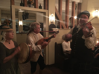
The day was not over yet. After a nerve-wracking detour around the naval base in Norfolk (and the amazing sight of a battleship being loaded by crane), we arrived in Colonial Williamsburg. After a delicious dinner at Berret's Seafood Restaurant, across the street from William and Mary College, we walked through Merchants Square and met a friend of Tim's and her husband for a stroll and drinks at Josiah Chowning's Tavern in Colonial Williamsburg. The atmosphere was cozy, and the sing-along was so fun!


Berret's Seafood Restaurant

My yummy meal at Berret's

Sing-along at Josiah Chowning's Tavern


Saturday, June 10, 2017

Revolution Road Trip: Dempsey Powell and Wake Forest

Leaving Kings Mountain, we drove through the small town of Lowell, looking for a place to eat. We found a great little diner called "Grits 'n Greens." Even at lunch, we couldn't escape history. We noticed that the large photographs on the walls were all of child textile mill workers in the late 1800's. One of us said, "I wonder if that has anything to do with Lowell, Massachusetts?" We googled, and sure enough, Lowell, North Carolina, took that name because they hoped to become a center of textile production. We were definitely in North Carolina, not Massachusetts, because the menu was all-Southern. I had the BLT with fried green tomatoes, and Tim had the special--fried chicken with greens and fried okra. Yum yum!


We were on our way to Wake County, North Carolina, to stay the night with my brother's brother-in-law and his family, and then on to Wake Forest to explore the area where our Powell ancestors lived. We were met with Southern hospitality, a great dinner, and fun by the pool, playing a colonial game called Shut the Box. I am completely addicted! It is a simple game, but so much fun, especially with a big group of family.


Shut the Box!

The next morning after breakfast by the pool, we took off for Wake Forest, about 40 minutes away. We were looking for the home of Jesse Powell, the son of our 5th great-grandfather, Dempsey Powell (See The Powells) and the brother of our 4th great-grandfather, Caswell Powell. We had the history of the house from an online article about downtown Wake Forest and the address from the Wake Forest Historic Preservation Plan, also available online.

I typed the address into Google Maps, and we found ourselves in Wake Forest on Capital Boulevard, a highway running past self-storage units and car lots. We couldn't imagine how there could be a 200+-year-old house where it was supposed to be. I didn't even see the little road running parallel to the highway and into a wooded area, but my brother did. He got us turned around to make another run at it, and this time we pulled off the highway and down a little road/driveway to find the Jesse Powell House, built about the year 1800.


According to the Wake Forest Downtown article, "Powell built the beautiful symmetrical Federal house that still stands on the east side of Capital Boulevard. He had inherited 318 acres on the north banks of the Neuse River after his father, Dempsey Powell, died in 1793, and later added several hundred more." We can also add Jesse to our list of education-minded family members; in 1826 he founded the Pleasant Grove Academy just across the road from the house.

In addition, he was responsible for building a road through Wake Forest, long known as the Powell Road and now part of South Main Street. Tim and I spent some time on North Main Street, walking through the historic district and admiring the beautiful houses and gardens. When I got home and did some research, I found out why the Jesse Powell House still stands, even so close to the highway. It was a conscious decision by the highway planners.

In a memorandum concerning the "Proposed Improvement of US 1, from US 401 Northward to Wake Forest Bypass, Wake County," dated 1972 and available through Google Books, the director of the survey staff made these statements: "We believe that the Powell House is of considerable importance, historically and especially architecturally...The house was built about 1800 by the Powell family, probably by Jesse Powell, son of Dempsey Powell, a soldier in the American Revolution...We believe that the Powell House is one of the very finest Federal country houses in Wake County and among the significant buildings of its type in the state. Its importance is such that if this alternate [the choice of highway direction] is selected, we urge strongly that you consider an arrangement that would not disturb it." And they did.

Dempsey Powell was our second connection to the Revolutionary War, and we were headed to Edenton, North Carolina, home of our Ming ancestors, where we would learn that the citizens of Edenton, especially the ladies, had a most interesting role in the lead up to the American Revolution.


Thursday, June 8, 2017

Revolution Road Trip: Jacob Castle and the Battle of Kings Mountain

I have been immersed in the American Revolution for the last week. Even though I planned our vacation in North and South Carolina and Virginia, and even though I was taking this trip with my American-history-teaching brother, I guess I didn't realize that so many places we would visit were significant in the war for American freedom from British rule. A vacation with a theme: what could be better?

Our first stop, after a 14-hour drive from Tulsa to Knoxville on the first day, and a 3-hour drive to South Carolina on the second, was the Kings Mountain National Military Park. I have been promising to write about Kings Mountain for a long time but was hoping to actually visit the battle site first. 

For years I have read both facts and folklore about my ancestor, Jacob Castle. It was often mentioned that he took part in the Battle of Kings Mountain, but until recently I didn't know where that information came from. Then I found the application of his son Bazle for his own Revolutionary War pension, in which he stated that he remained at home in southwestern Virginia while his father Jacob "went with the Virginia Volunteers to South Carolina, and was under Campbell at the battle of Kings Mountain, in consequence of which he [Bazle] had to stay at home until his [Jacob's] return in the winter of 1780 in the month of February" [1781]. 


Bazle Castle's application for a Revolutionary War pension,
including statement that his father was at Kings Mountain


I didn't realize that Kings Mountain was such a big deal. We've all heard about Lexington and Concord, Bunker Hill and Yorktown, but who has ever heard of Kings Mountain? And yet, Thomas Jefferson, writing in 1822, called the battle "the joyful annunciation of that turn of the tide of success which terminated the Revolutionary War, with the seal of our independence." After years of battling the British to a draw (or losing) in the Northern states, the victory at Kings Mountain discouraged British plans for the Southern states and spelled the beginning of the end of the Revolutionary War.

And it all began with a boastful threat by a British major by the name of Patrick Ferguson.

Patrick Ferguson's title was British Inspector of Militia for the Southern Provinces. His job was to recruit and train Loyalists--those colonists that were still loyal to the British crown. Believing that the Southern states were predominantly Loyalist, British General Cornwallis sent Ferguson to organize the Loyalist militia in the South. He hoped to consolidate his position there in order to put pressure on the American forces elsewhere.

Ferguson was a soldier through and through, disciplined and for the most part, honorable. He was also considered the best marksman in the British Army. At the Battle of Brandywine in 1777 he had the opportunity to fire at an American officer and wouldn't take the shot because he would have shot the officer in the back. The officer was George Washington. Later in the same battle, his right elbow was shattered by a musket ball, and he never regained full use of it. His response to this disaster was to learn to shoot just as well with his left hand. 

There was much to admire about Patrick Ferguson, but his training and talent also made him arrogant. He despised the American militia forces for their unorganized way of fighting "Indian style." In skirmishes in North Carolina with the militia led by Colonel Charles McDowell, the Americans had ambushed Ferguson's troops, and then retreated to their homes over the Blue Ridge and Appalachian Mountains. Ferguson sent them a message via a captured Patriot militiaman: "If you do not desist your opposition to the British Arms, I shall march this army over the mountains, hang your leaders, and lay waste your country with fire and sword."

As soon as Isaac Shelby (future governor of Kentucky) got the message, he rode to the home of John Sevier (future governor of Tennessee), and together they made plans to take the battle to Ferguson. They sent messengers to North Carolina and to militia leaders, Arthur and William Campbell, in Virginia. They agreed to meet at Sycamore Shoals (near today's Elizabethton, TN) on September 25. Shelby brought over 200 men, as did Sevier. William Campbell brought 400 men who had mustered at Abingdon, VA (about 30 miles from Castle's Woods.) With the addition of McDowell's men who had retreated to this area following the skirmish with Ferguson, this force consisted of one thousand men--some on horseback, some on foot--who set off on September 26 to find Patrick Ferguson and engage him far from the homes he had threatened.

As Randell Jones, author of A Guide to the Overmountain Victory National Historic Trail, points out: "This was not an army in the strictest sense of the word. All the men were civilians; none was a Continental soldier, although most were experienced militiamen, having fought for years against Cherokees, Chickamaugas, Shawnees, and tories...The men were all skilled hunters and woodsmen. They were fighters, too, but they lacked the strict discipline of a military unit." This is why Patrick Ferguson looked down on them, but you also have to remember that Ferguson's men were militia, too. 

Okay, this is one of my favorite parts, because it's a connection to the other side of my family. On September 27 the thousand-man force began to climb Roan Mountain and found themselves in a meadow covered with snow that they described as "shoe-mouth deep." I laughed out loud when I read that for the first time. That was one of my grandpa Weaver Smith's favorite expressions. (See Grandparent #1: Weaver Harris Smith) I always thought it expressed perfectly a depth of two or three inches. The original home of my Smiths is such a mystery. It makes me wonder if that expression comes from the Overmountain region, or just the South in general. Up until I read that I had never heard anybody else use it, except my grandpa.

Also at Roan Mountain roll is called, and it is discovered that two men, obviously with Loyalist leanings, have deserted to warn Ferguson that the Overmountain men are looking for him. They expect to find Ferguson at Gilbert Town in southern North Carolina, but when they reach there, he is gone. They at first head west, away from Kings Mountain, thinking they are following Ferguson, but soon get news that he is headed east. 

Again quoting Randell Jones, "As the Patriots continued riding east, they learned from local residents that Ferguson was encamped atop Little Kings Mountain. It was a promontory rising about 60 feet above the surrounding terrain [more a hill than a mountain, my words]. The open area at the top was oblong, a few hundred yards in length and narrowing from 120 to 60 yards across...Ferguson had selected his campsite on top of the mountain believing that the high ground afforded him a military advantage should the Patriot militia catch up to him." At Cowpens, just west of Kings Mountain, on the evening of October 6, the Overmountain Men chose their best 900 armed and mounted men, and they pushed on to meet Ferguson's 1,000-man Loyalist army atop Kings Mountain. 


Today's Kings Mountain National Military Park is wooded and peaceful. We learned from our visit that the sides of the promontory would have looked different at the time of the battle. Where today there are many mature trees, saplings, and underbrush, in 1780 the existing trees would have been very old and very big, blocking the sunlight from reaching below their canopies. There would have been no saplings or underbrush. While the trees might have offered some cover, there was plenty of space between the trees for the militia on both sides to meet in battle. 

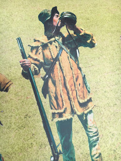
The predominant weapon on both sides of the Revolutionary War was the Brown Bess muzzle-loading musket, because it could be loaded and fired three to four times in a minute, although it was very inaccurate. Lines of soldiers in open-field combat had an advantage because they could fire together and quickly at an oncoming force and then use the attached bayonet to "finish the job." In the battle at Kings Mountain the Loyalist forces were carrying Brown Bess muskets. However, the Overmountain Men were carrying long rifles that they used at home for hunting and protection. According to the National Park brochure for the Kings Mountain park, Kings Mountain was the "only battle in the war in which the primary weapon of the patriot forces was the American long rifle." The long rifle took a minute to load, but was much more accurate than the musket. 


Overmountain Man at Kings Mountain NP


In the conditions at Kings Mountain, the long rifle was an advantage. The Loyalist forces coming down the mountain to meet the Patriot forces tended to shoot over the Patriots' heads, although when they got close enough, their bayonets were deadly. The Patriots were forced to retreat, and the Loyalists returned to the top of the hill. The Patriots again made an advance up the hill, "taking deadly aim with their hunting rifles and claiming victim after victim" [Randell Jones]. On their third advance, they took the top of the mountain.

At this point Patrick Ferguson rode toward the Patriot lines, probably in an attempt to escape capture, and was shot by one of the Patriot militiamen. As he fell from the saddle, his foot caught in the stirrup, and his horse dragged him around as more Patriots (at least 6 or 7) fired into his body. At the death of Ferguson, the Loyalists quickly surrendered. Along with Ferguson, 120 Loyalists died, and the rest were wounded or captured. The Patriot losses were 28 killed, 62 wounded.

Heading back toward Gilbert Town with their prisoners, the Patriots stop along the way at Biggerstaff's Plantation for a quick trial of the Loyalist prisoners. They condemn 30 to death and hang 9 of them before the proceedings are brought to a halt by Isaac Shelby. 

The victory of the Overmountain Men at Kings Mountain altered the plans of General Cornwallis. Instead of advancing into North Carolina, as was his original plan, he retreated to South Carolina for the winter. No longer could he depend on a large number of Loyalists in the South, as the events at Kings Mountain encouraged Patriot sentiment in the South and discouraged Loyalist support. British General Sir Henry Clinton, overall commander in North America, remarked that Kings Mountain was "the first link in a chain of evils...that ended in the total loss of America."

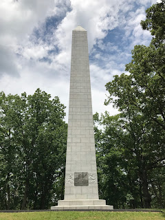
The battlefield was untouched until 1815 when Dr. William McLean initiated an effort to commemorate the battle. This included cleanup of the site, reburying of the bones of the dead, and dedication of a marker honoring four of Dr. McLean's neighbors from North Carolina and Patrick Ferguson. A monument was erected in 1880, and another in 1909. In 1930 on the 150th anniversary of the battle a marker was placed at Patrick Ferguson's cairn on the mountain, which reads "This memorial is from the citizens of the United States in token of their appreciation of the bonds of friendship and peace between them and the citizens of the British Empire."


1909 Monument
Patrick Ferguson marker erected 1930


My brother and I mentioned often on this trip that it's weird how often members of the two sides of our family, our dad's and our mom's, were living in the same areas and engaged in the same events. Isaac Shelby, one of the militia leaders at Kings Mountain and future governor of Kentucky, commanded our paternal ancestor Jacob Castle at Kings Mountain and our maternal ancestor William Whitley at the Battle of the Thames, which Shelby survived. He is buried at his home in Kentucky, Traveller's Rest, less than 30 miles from William Whitley's home at Sportsman's Hill.